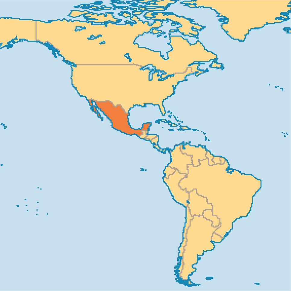
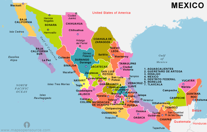
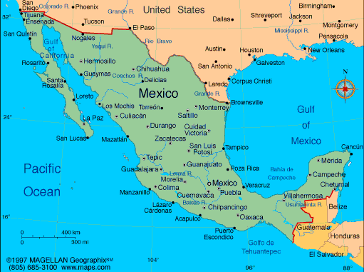
Geography
Mexico Maps
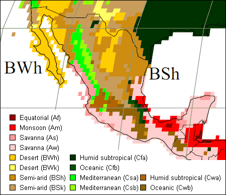
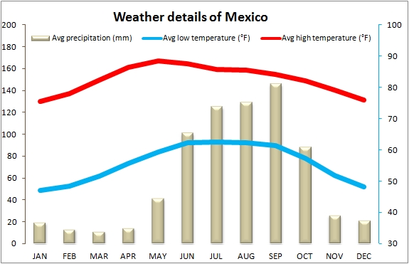
Mexico Climate
Along the coast (on both sides of the country) it is hot and humid, unbearably so in the summer.
Inland communities at higher elevations such as Guadalajara (5200 ft above sea level) and in particular close-by Lake Chapala, are much dryer and more temperate.
Mexico City (Ciudad de Mexico), with its much higher elevation of 7545.93 ft (2300 sq meters) above sea level, can reach freezing temperatures in the winter. You'll be surprised to find snow-capped volcanoes. San Miguel de Allende also experiences colder winters due to its close proximity to Mexico City.
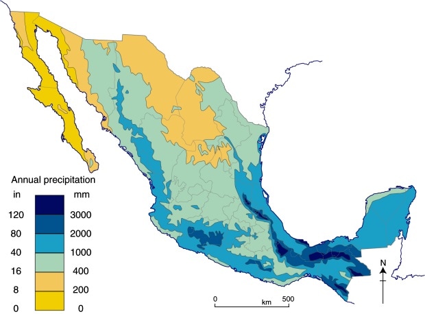
Rainfall
The average yearly rainfall in Mexico between the years 2010 and 2014 was 758 millimeters, or 29.84 inches. However, rainfall varies greatly depending on location and elevation above sea level.
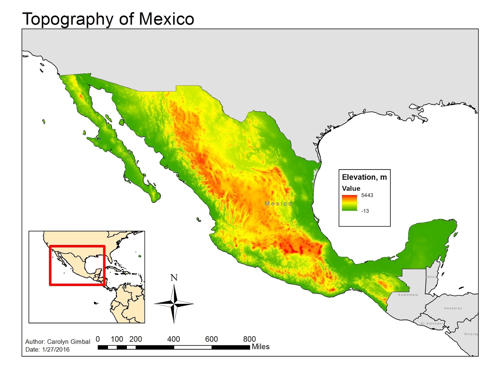
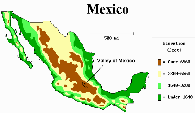
Terrian
Terrain: high, rugged mountains; low coastal plains; high plateaus; desert. Elevation extremes: lowest point: Laguna Salada -10 m. highest point: Pico de Orizaba volcano 5,700 m.
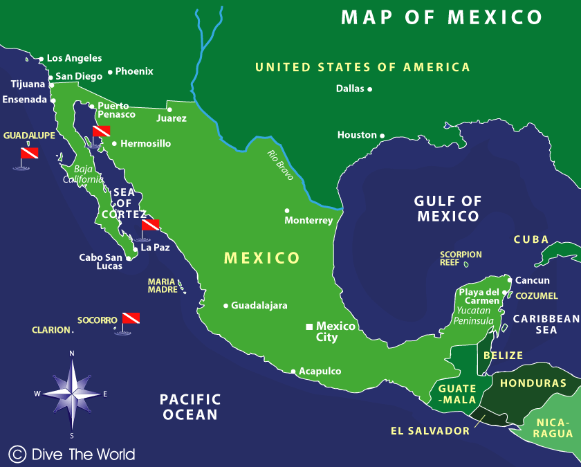
Seas
Mexico is bordered to the west and south by the Pacific Ocean, to the east by the Gulf of Mexico, and to the southeast by the Caribbean Sea.
Seasons
Hottest Months: The hottest months are April & May in the South, and July to September on Pacific Coast (Including Baja), and extremely hot in the Yucatan May to September.
Coolest Months: Vary by region, but generally December, January, February; the Yucatan can still experience hot weather even in the coolest months.
Rainy Season in Mexico: Mexico’s Rainy season runs from May to September (sometimes extends to October) each year. Most regions south of the Tropic of Cancer (near Mazatlan) are affected. Rain storms usually arrive in the late afternoon accompanied by thunder and lightning, creating torrential downpours before passing and leaving the evenings dry and cooled off.
See Article: Mexico’s Rain Season
Hurricane Season in Mexico: June, July, August, September, October (sometimes extends into November): Can affect weather on the Yucatan Peninsula, (e.g. Cancun), as well as weather on Mexico’s Pacific coast, from Baja California southwards.
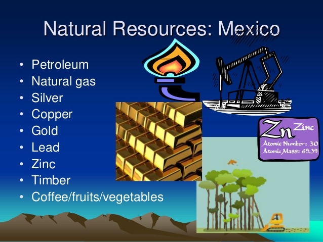
Natural Resources
Mexico has large deposits of silver, copper, salt, fluorspar, iron, manganese, sulfur, phosphate, zinc, tungsten, molybdenum, mercury, gold, and gypsum. Petroleum is the country's single most valuable mineral resource.
Sea Level Chart
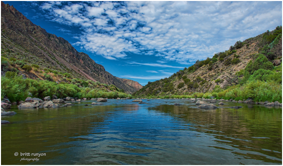
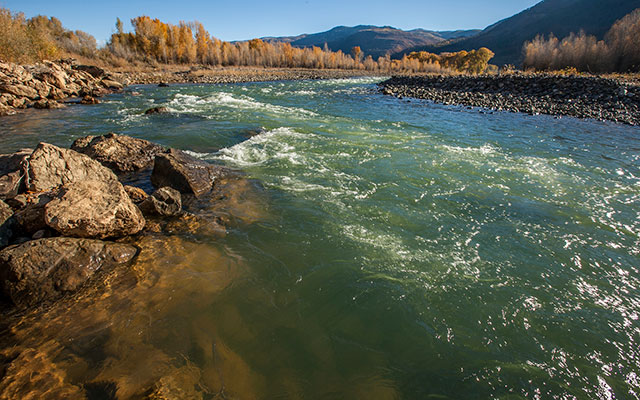
Rivers
Rio Grande
The Rio Grande is one of the principal rivers in the southwest United States and northern Mexico. The Rio Grande begins in south-central Colorado in the United States and flows to the Gulf of Mexico. Along the way, it forms part of the Mexico–United States border. According to the International Boundary and Water Commission, its total length was 1,896 miles (3,051 km) in the late 1980s, though course shifts occasionally result in length changes. Depending on how it is measured, the Rio Grande is the fourth- or fifth-longest river system in North America.
Colorado River
The Colorado River is one of the principal rivers of the Southwestern United States and northern Mexico. The 1,450-mile-long (2,330 km) Colorado River drains an expansive, arid watershed that encompasses parts of seven U.S. and two Mexican states. Starting in the central Rocky Mountains in the U.S., the river flows generally southwest across the Colorado Plateau and through the Grand Canyon before reaching Lake Mead on the Arizona–Nevada border, where it turns south toward the international border. After entering Mexico, the Colorado approaches the mostly dry Colorado River Delta at the tip of the Gulf of California between Baja California and Sonora.
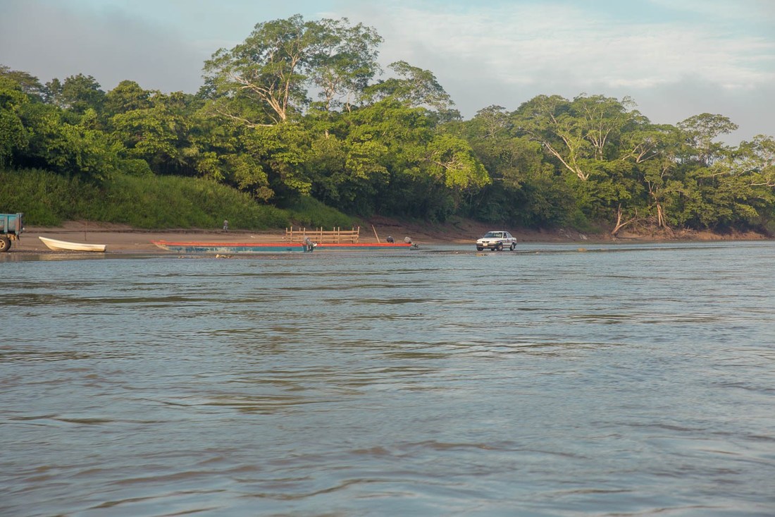
Usumacinta River
The Usumacinta River is a river in southeastern Mexico and northwestern Guatemala. It is formed by the junction of the Pasión River, which arises in the Sierra de Santa Cruz (in Guatemala) and the Salinas River, also known as the Chixoy, or the Negro, which descends from the Sierra Madre de Guatemala. It defines part of the border between Guatemala and the Mexican state of Chiapas, then continues its northwesterly course, meandering through the Mexican state of Tabasco to the Gulf of Mexico.
Lakes
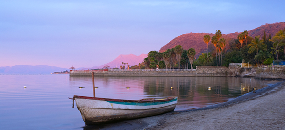
Lake Chapla
It is located 45 km southeast of Guadalajara, Jalisco, and is situated on the border between the states of Jalisco and Michoacán, at 1,524 metres (5000 feet) above sea level. Its approximate dimensions are 80 km (50 mi) from east to west and averages 12.5 km (7.8 miles) from north to south, and covers an approximate area of 1,100 km2 (420 sq mi).It is a shallow lake, with a mean depth of 4.5 metres (15 ft) and a maximum of 10.5 m (34 ft).
It is fed by the Río Lerma, Río Zula, Río Huaracha, and Río Duero rivers, and drained by the Rio Grande de Santiago. The water then flows northwest into the Pacific Ocean.
It is fed by the Río Lerma, Río Zula, Río Huaracha, and Río Duero rivers, and drained by the Rio Grande de Santiago. The water then flows northwest into the Pacific Ocean.
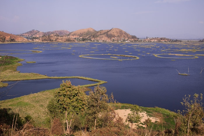
Lake Texcoco
The Valley of Mexico is a basin with an average elevation of 2,236 metres (7,336 ft) above mean sea level located in the southern highlands of Mexico's central altiplano. Lake Texcoco formerly extended over a large portion of the southern half of the basin, where it was the largest of an interconnected chain of five major and several smaller lakes (the other main lakes being Xaltocan, Zumpango, Chalco and Xochimilco lakes). During periods of high water levels—typically after the May-to-October rainy seasons—the lakes were often joined as one body of water, at an average elevation of 2,242 metres (7,356 ft) above mean sea level.
Mountains
Pico de Orizaba
Pico de Orizaba, is a stratovolcano, the highest mountain in Mexico and the third highest in North America, after Denali (formerly known as Mount McKinley) of the United States and Mount Logan of Canada. It rises 5,636 metres (18,491 ft) above sea level in the eastern end of the Trans-Mexican Volcanic Belt, on the border between the states of Veracruz and Puebla. The volcano is currently dormant but not extinct, with the last eruption taking place during the 19th century. It is the second most prominent volcanic peak in the world after Africa's Mount Kilimanjaro.

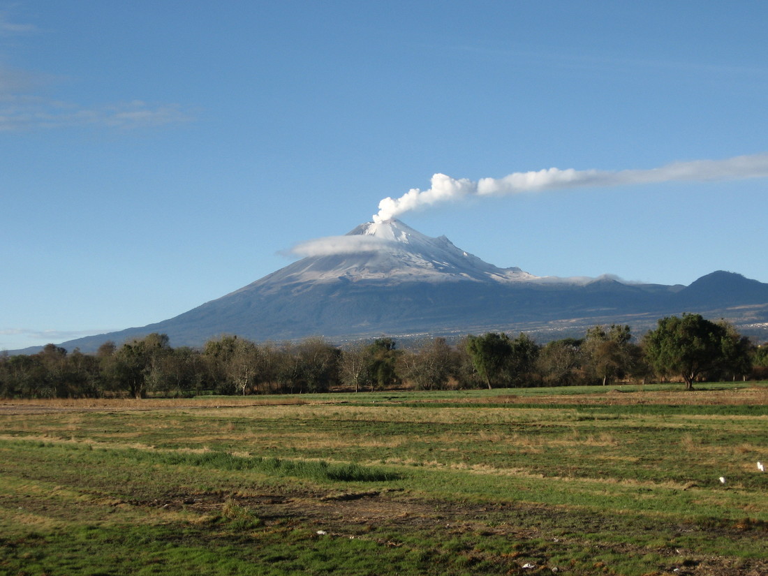
Popocatépetl
Popocatépetl is an active volcano, located in the states of Puebla, Mexico, and Morelos, in Central Mexico, and lies in the eastern half of the Trans-Mexican volcanic belt. At 5,426 m (17,802 ft) it is the second highest peak in Mexico, after Citlaltépetl (Pico de Orizaba) at 5,636 m (18,491 ft).